
20.5km
Crocodile Trail
20.5km
+1200m


Route
The race begins on the coastal road of Sougia, heading west.
The first 500 meters are on a flat paved road. After passing Sougia’s small port on the left, runners enter the well-known E4 trail, which connects Sougia with Ancient Lissos and Paleochora.
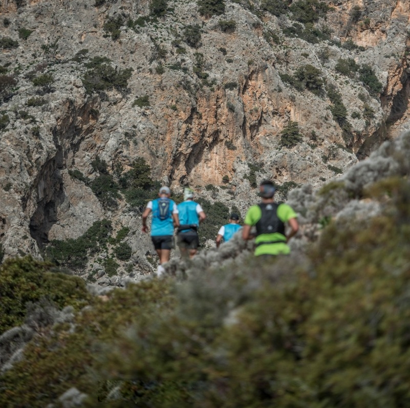
From this point on, the entire course follows a rocky, technical trail that requires special attention.
Entering the Sougia Gorge, the trail follows the ancient path that once linked the ancient cities of Syia and Lissos, starting with a 1.5 km ascent (+165 m elevation), followed by a 1 km descent.
Caution: In case of rain, special care is required when exiting the forested area just before completing this ascent, as it becomes muddy and dangerously slippery.
On the descent, runners are treated to a view of Ancient Lissos Bay, passing on the right the Temple of Asclepius with its famous mosaic floor, the recently excavated ancient theater, and the healing spring, which still flows and is safe to drink from.
Leaving Ancient Lissos, the trail becomes a steep, rocky, and winding path of 1.6 km (+240 m elevation) across sharp rocks.
Walking is recommended, especially toward the end, just before the Lichnou Lakkos aid station, where the rocks are razor-sharp.
At the Lichnou Lakkos aid station (5.0 km), take time to refuel. From here, follow a lightly downhill, abandoned dirt track for 400 meters. For the first time, Paleochora becomes visible in the distance. The route then drops into a 2 km steep and unstable downhill trail leading to Ammoutsaki Beach.
This is followed by 3 km of gentle slopes, offering a chance to catch your breath, leading to the second aid station at Gialiskari (10.0 km).
At this point, the course leaves the E4 trail. Markings change to orange signs with red-and-white tape. The route turns north, ascending toward the village of Anydroi, moving along both sides of the Anydroi Gorge. Just before exiting the gorge, the path sharply turns west and climbs a steep rocky scree slope that leads to just above the midpoint of the classic climb to the Chapel of Prophet Elias. Ring the bell, enjoy the panoramic view of the South Cretan Sea and Gialiskari, then descend along a 0.5 km winding, steep, and technical trail.
Here you’ll find the Anydroi aid station (12.7 km), an ideal spot to refuel with food and drinks for the remainder of the race.
Next, for about 1.5 km, follow a farm road that starts downhill and becomes undulating. Then re-enter a steep, unstable downhill trail, about 1 km long, while taking in the views. Gather strength for the final stretch as you reach the fourth major aid station at Keratides (16.0 km).
Continue for 1.5 km along the seaside without elevation changes, moving through the outskirts of Paleochora, until you face the final and by far most challenging climb of the race — requiring both hands and feet to ascend 0.8 km with +215 m elevation gain.
At the summit, Vigles (18.0 km), you’ll enjoy a breathtaking view of the South Cretan Sea, the southwestern face of the White Mountains, the rugged interior, and of course your destination — Paleochora.
From here, only 2.5 km remain to the finish line, 1.5 km descent on a steep, abandoned dirt road, followed by 1 km of flat terrain through the town of Paleochora to the finish.